History of Keçiören
Myths about the Origin of the Name Keçiören
In historical texts about Ankara that usually begin with Ankara Castle and end with Çankaya, the names Keçiören and Etlik are rarely mentioned. In historical sources, the name Keçiören appears more frequently during the years of the War of Independence and the Republican era. However, Keçiören is actually one of Ankara’s oldest settlements.
Among the various accounts regarding the origin of its name, one possibility is that Keçiören derives from the words “keçi” (goat) and “ören” (ruins/ancient site). Considering that this region is the homeland of the world-famous Angora Goat and that many historical artifacts have been unearthed here, this explanation seems quite meaningful.
Another account suggests that in a region where the historic Silk Road and King’s Road once passed, the name evolved from the locally pronounced word “geçiveren,” meaning “a place people pass through.” Another narrative claims that the name comes from “keçe” (felt), as felt production once took place in the area.
It is also said that the name may have derived from the word “geçveren,” referring to the late-ripening grapes grown in Keçiören’s legendary vineyards.
In addition to all these, the most plausible explanation is found in historical records. In the Ankara Mufassal Tahrir Register from the period of Sultan Mehmed the Conqueror, the area is referred to as “Karye-i Kiçiviran Tab-i Kasaba” (Small Ruined Village Attached to the Town). From this, it is understood that the name “küçük viran” eventually transformed into Keçiören over time.
Although the name originates from Kiçiviran, Keçiören today is neither “small” nor “ruined.” It is now one of Ankara’s most developed districts, sharing its historical, natural, and cultural richness with all residents of the capital.
Geographical Structure and Location
Keçiören is one of the metropolitan districts of the capital city, Ankara. It is bordered by Pursaklar to the east and northeast, Çubuk to the north and northeast, Kazan to the northwest and west, Yenimahalle to the southwest, and Altındağ to the south and southeast. Geographically, it lies between 32.74° east longitude and 40.08° north latitude, with an approximate surface area of 98.1 km².
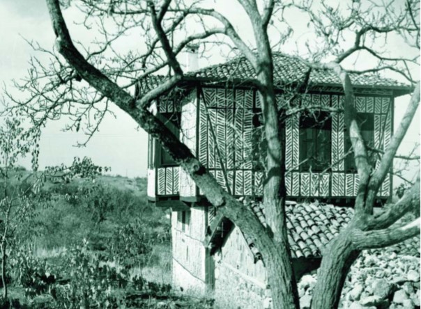 Keçiören’s geography consists of rugged high plateaus, narrow and steep valleys, and hills. A century ago, the regions of Keçiören, Etlik, Ayvalı, Kalaba, and Bağlum were known as the area where Ankara’s famous vineyards and fruit–vegetable gardens were located.
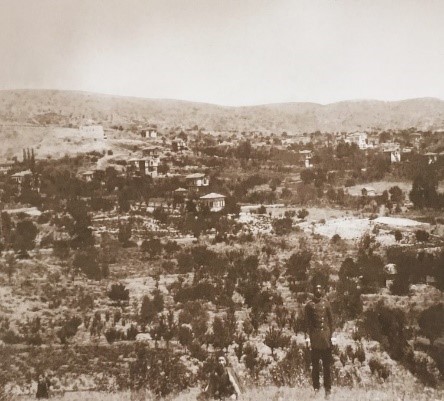 Over time, these vineyards and gardens were opened for development, and dense urbanization began in the area. As a result, Keçiören emerged as the most densely populated metropolitan district of the capital, Ankara.
Keçiören’s Position in the Course of History
Anatolian Civilizations Period
Due to its location, Keçiören has been close to the north–west transportation routes and the center of Ankara since ancient times; therefore, traces of human life dating back to early eras can be found throughout the region.
The presence of Çubuk Stream passing through the Kalaba Valley, the Hacıkadın Creek valley forming a low-based valley close to Çubuk Stream, the Bağlum Hisar Hill offering a terrace with a commanding view of the surroundings, and the existence of andesite rock formations made the region highly suitable for human settlement. For these reasons, the area has been inhabited since antiquity.
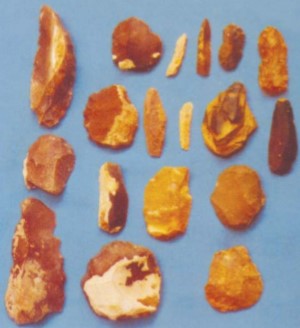
Silex tools, arrowheads, and cutting implements belonging to this period have been found on the slopes of Hatip Stream, Ankara Stream, Ova Stream, Çubuk Stream, Kirmir Stream, and İncesu Creek both in the city center of Ankara and in its rural surroundings. This indicates that a hunter-gatherer lifestyle prevailed during that era.
The Çubuk Stream valley, the waterways that flow into it, the surrounding flat areas, and the oak forests that no longer exist today were significant factors supporting human life during this period.
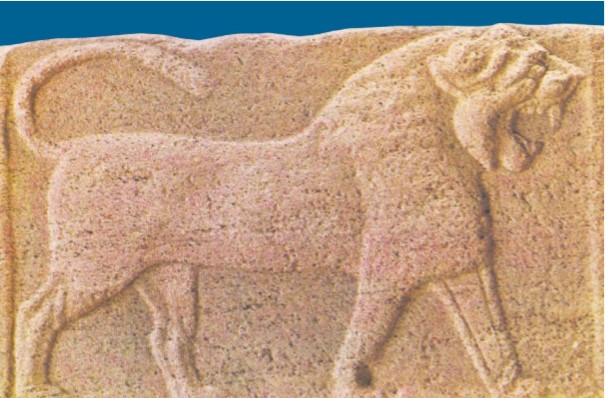 A Phrygian-period rock tomb located in the rocks where the waterfall stands in the Kalaba neighborhood of Keçiören has survived to the present day. In 1861, the French archaeologist Georges Perrot discovered a basalt lion relief in the Kalaba neighborhood and a griffin-decorated Cybele relief in the Etlik neighborhood. These reliefs and sculptures are exhibited in the Museum of Anatolian Civilizations
Selcuk Period
Following the Battle of Manzikert, Turkmen beys under the command of the Seljuks began incursions into the inner parts of Anatolia—then referred to as the “Land of the Romans”—for the purpose of settlement. Ankara, which was under the rule of the Anatolian Seljuk State, was occupied during the First Crusade in 1101. However, in the same year, near Merzifon, the Crusader armies were defeated, and Byzantine control over the region remained very short-lived.
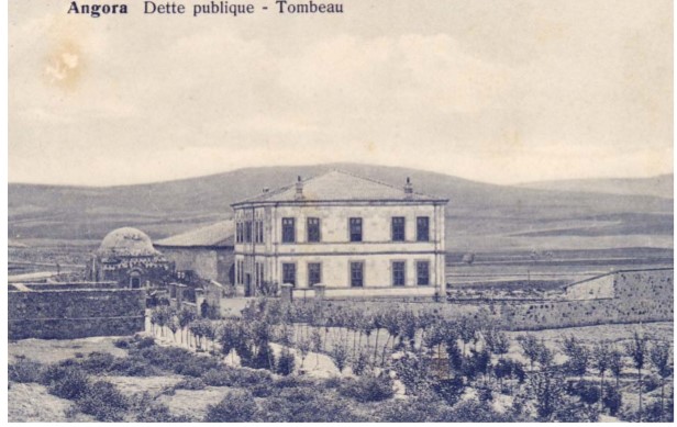 The mosque, madrasa, and tomb built in Ankara by Kızıl Bey, one of the viziers of Sultan Izzeddin Keykavus
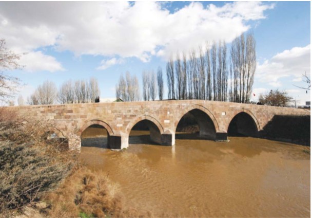
The Selcuk Monument: Ak Bridge
During Sultan Keykubad’s eighteen-year reign, the Selcuk Empire’s land and naval military power reached its peak. Bridges, inns, and caravanserais were constructed along caravan routes. The Ak Bridge, located over the Çubuk Stream, was built during this period. Science, art, education, trade, crafts, and animal husbandry flourished. Scholars and craftsmen fleeing the Mongol invasions settled in Ankara and its surrounding towns. The Turkmen population in the region increased, and new villages were established.
Ottoman Empire Period
In 1356, during the reign of Orhan Gazi, the region came under the control of the Ottoman Beylik. When the armies of Timur and Yıldırım Bayezid confronted each other in the Çubuk Plain in 1402, Yıldırım Bayezid used the Kalaba neighborhood, located within the present-day Keçiören district, as his military headquarters.
In Ottoman Tahrir Registers and foundation records (vakıf documents), the villages and hamlets located within the present-day boundaries of Keçiören during the reign of Sultan Murad I Hudavendigar are recorded as follows:
Galebe/Galaba (Kalaba) Valley, Kiçi-viran (Keçiören) Village, Etlik Village, Ovakcık Village, Galebe/Galaba (Kalaba) Village, Yavlün (Bağlum) Village, Kösrelik Village, Lezgi (Sarıbeyler) Village, Geldi-buldu (Güzelyurt) Village.
Structures from the Ottoman Period
Kiçiviran and its surrounding areas were known during the Ottoman era for their famous Ankara vineyards. Kiçi-viran, which was a small settlement in the early Ottoman period, later became a lively summer retreat for residents of the city, with vineyards and vineyard houses being constructed.
Galebe, on the other hand, continued its existence as a village settlement. Some of the structures mentioned in Ottoman archival records and located within today’s Keçiören district have not survived. These include schools, zawiyas (dervish lodges), mosques, monasteries, churches, bridges, and vineyard houses.
Sheikh Muzaffer Zawiya
According to Ottoman foundation records, the zawiya built by Sheikh Muzaffer was located in the Galebe Valley.
Galebe (Kalaba) Village Mosque
The old Galebe Village Mosque was demolished and a new mosque was built in its place.
Manastır Bridge
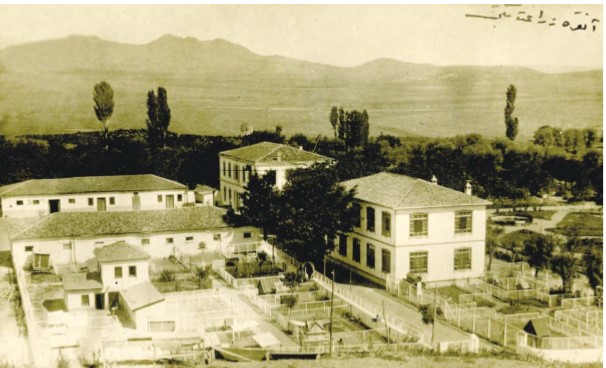
The Manastır Bridge, which once stood over the Çubuk Stream and has since been demolished, was named so because it provided access to an Armenian monastery that no longer exists today.
Numune Farm
Constructed during the reign of Sultan Abdulhamid II along the Galebe (Kalaba) village road, the farm was converted into the School of Agriculture and Applied Training in 1902 after its deficiencies were completed. Following Gazi Mustafa Kemal Atatürk’s arrival in Ankara on 27 December 1919, several civilian journalists, writers, and statesmen who accompanied him or arrived shortly afterward—such as Yunus Nadi, Halide Edip Adıvar, Adnan Adıvar, and Hamdullah Suphi Tanrıöğer—stayed in this building.
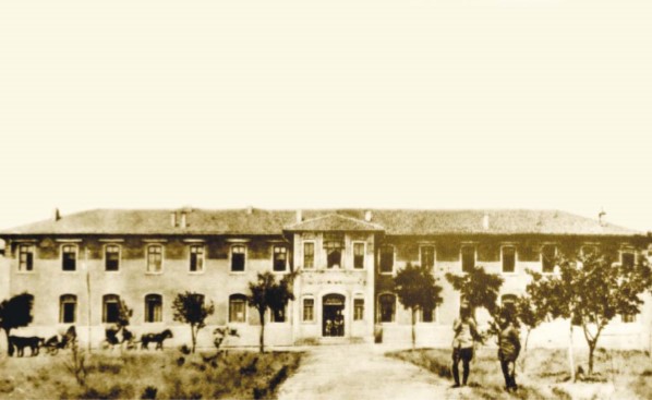
Ankara School of Agriculture
On 6 May 1895, a grand ceremony attended by Ankara Governor Memduh Pasha and other prominent figures of the city marked the groundbreaking of the “Shepherding and Herdsmanship School” of the Ankara Numune Farm. When Mustafa Kemal Pasha, the initiator of the National Struggle movement in Anatolia, arrived in Ankara on 27 December 1919 with the members of the Heyet-i Temsiliye, he settled in the School of Agriculture located near Kalaba Village. Thus, the Ankara School of Agriculture became the first headquarters building of the National Struggle.
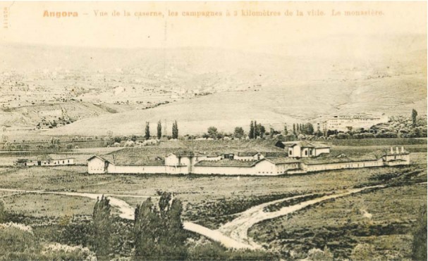 Virgin Mary (Kızıl) Monastery
Ottoman archival documents mention the existence of the “Virgin Mary Armenian Monastery” in Ankara. In 1858, there were seven old Armenian churches in Ankara and one monastery located outside the city. On a map drawn in 1892 by the German cartographer Nach v. Vinken, a structure labeled “Kızıl Monastery” is shown to the west of Galebe (Kalaba) Village, near the Çubuk Stream.
Dede Fountain
The “Dede Fountain,” located today near the Güzelyurt Neighborhood Mosque, was built in 1879.
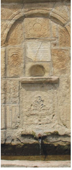 Bağlum Fountains
There are many fountains in Bağlum that were built during the Ottoman period. The most significant of these is the fountain located at the intersection of Bağlum, Uluharman, and Menderes streets.
Establishment as a Subdistrict (Nahiye)
Keçiören, whose history as a subdistrict (nahiye) dates back to the years 1200–1300, became a bucak (subdistrict) in 1936 following the expansion of the lands belonging to the villages of Keçiören, Kalaba (Galebe), Etlik, and Ovacık. The first Nahiye Director was Osman Bedrettin Yolga. He was later succeeded by Mehmet Derviş Çiyiltepe, Ahmet Feridun Demir, Nafi Muharremgil, Osman Macit Atay, Suphi Günay, and Hakkı Tataroğlu.
Becoming a District in 1984
Keçiören was affiliated with the Altındağ district in 1966 and became an independent district in 1984. Within the municipal boundaries of Keçiören, there are 43 neighborhoods. Additionally, the villages of Alacaören, Kılıçlar, Gümüşoluk, Kösrelik, Kurusan, Saray, and Sarıbeyler, as well as the townships of Bağlum and Pursaklar, which fall within Keçiören’s district boundaries, were also incorporated into the district.
Republic Period
Keçiören, which witnessed the years of the National Struggle and the establishment of the Republic, became home to many prominent figures—members of parliament, businessmen, writers, and journalists—after the proclamation of the Republic. For a long time, it preserved its reputation as a retreat area preferred by the wealthy. Vineyard houses and private mansions became places where Keçiören’s socio-cultural character was sustained.
With its houses situated in gardens full of various fruit trees, pools, wells, and chicken coops, Keçiören was for many years a summer resort for middle-income and affluent residents of Ankara. The population movement—people moving to their vineyards in May and returning to the city center in September—gradually shifted after the 1950s into a one-directional, permanent migration. Now, newcomers were no longer from Ankara but from all over Türkiye. These new residents were the poorer segments who developed their own solutions to the housing pressure caused by Ankara’s rapidly growing population.
The phenomenon of gecekondu (squatter housing) became the unavoidable fate of both Etlik and Keçiören, as in many districts of Ankara. The first gecekondus, which appeared around Sanatoryum, Taşocağı, and the old cemetery area in Kalaba, quickly spread across Keçiören. The gecekondu prevention plans implemented in Aktepe could not stop this spread. The 1970s marked the beginning of the apartment-building era. Although a few two- or three-story apartment houses built by wealthy landowners already existed, the real apartment boom began with contractors known as yapsatçı, who built apartments in exchange for land shares—a trend that still continues today. These yapsatçıs now construct apartment buildings for the owners of state-owned lands on which they had previously built gecekondus, based on title allocation documents issued to them. The crowded, monotonous apartment blocks resulting from this situation, combined with a continually increasing population, can be considered one of the most significant structural problems of contemporary Keçiören.
In an article published in the 1990s in the first issue of Ankara, a city culture magazine of the Metropolitan Municipality—which has remained irreplaceable for years—Prof. Dr. İlber Ortaylı notes that Ankara, despite being a modern and problematic capital, still retains an old urban fabric better preserved than in many Anatolian cities, contrary to common belief. He highlights the old vineyard houses in Keçiören, standing within a nature that was gradually turning into concrete. Among Keçiören’s legendary vineyard houses, one of the most notable belonged to the Russians, who opened one of Ankara’s first embassies and hosted grand receptions attended occasionally by Atatürk. After the fire of 1916, the Russian Embassy—having temporarily moved to the mansion of former mayor Mavioğlu in Hamamönü—settled in its own building on Atatürk Boulevard in 1925, but it is known that they once had a vineyard house in Keçiören. This was not the only diplomatic residence in the area; the Tarman Mansion near Dutluk Stop was used as the Polish Embassy during the early years of the Republic.
One of the notable residents of these vineyard houses was the famous architect Arif Hikmet Koyunoğlu. In his memoirs, the architect of many prominent buildings in Ankara, Koyunoğlu writes that he bought Ankara’s third automobile after Atatürk and Erzurumlu Nafiz. He later decided to buy a vineyard house and approached Mustafa Efendi, the father of Vehbi Koç—one of Keçiören’s well-known residents—to purchase an old recreational house. An interesting negotiation took place: since Koyunoğlu was an architect and Mustafa Efendi sold construction materials, both were familiar with costs. Although Mustafa Efendi had not intended to sell the house, he told Koyunoğlu, “You are an architect; you know the calculations. How much do you offer?” When Koyunoğlu replied—knowing it was a low amount—that he had only 10,000 liras, Mustafa Efendi generously responded: “8,000 liras is enough. You will need money to repair the house, so consider the remaining 2,000 liras a gift for the repair costs.”
Vineyard houses in Etlik and Keçiören also supported state officials arriving from Istanbul or Anatolian towns who had difficulty finding housing in Ankara. Ankara businessman Vehbi Koç’s memoirs also refer to these vineyard houses.
“ It was customary in Ankara to go to summer houses. There was also a lot of malaria. For this reason, middle-class and wealthy families went to the vineyards during summer. According to one’s wealth, people had carriages with two or one horse, or a single donkey. In Ankara, the three best summer resorts were Keçiören, Etlik, and Çankaya. (…) Our vineyard was in the Çoraklık area below Keçiören. Relatives and friends all lived in this area. Çoraklık was inhabited mostly by Muslims like us. A little further ahead in Keçiören lived many Catholics and Armenians. Their gardens and houses were beautifully maintained and immediately noticeable. After these Christians left Ankara, their houses were sold. Keçiören, with its fresh air, was one of Ankara’s finest summer areas. Atatürk’s Pavilion was originally planned to be built where the current hospital stands. For some reason, the plan was abandoned, and it was built in Çankaya instead.”
Prominent Residents of Keçiören
Many well-known figures lived in Keçiören. According to Keçiören Municipality’s publication (Keçiören Belediyesi, 2004), numerous distinguished people spent parts of their lives in Keçiören, including:
Thinker and statesman Ahmet Ağaoğlu; former prime ministers Bülent Ecevit and Hasan Saka; 3rd President Celal Bayar; military leaders and statesmen Fevzi Çakmak, Refet Bele, Hüseyin Rauf Orbay, Kazım Özalp, Recep Peker; statesman and intellectual Hamdullah Suphi Tanrıöver; writer Halide Edip Adıvar; physicians and statesmen Dr. Adnan Adıvar and Dr. Reşid Galip; and cinema and theatre artists Belgin Doruk and Defne Yalnız.
Other sources add even more names: Atatürk’s aide-de-camp Cevat Abbas; early TBMM deputies such as Emin Sazak; poet-deputy Aka Gündüz; leading Turkish nationalist thinkers Ziya Gökalp and Yusuf Akçura; former Director General of Primary Education and architect of the Village Institutes İsmail Hakkı Tonguç; historian İlber Ortaylı; architect-poet Ali Cengizkan; and journalists Güneri Civaoğlu and Güngör Uras.
Journalist Güneri Civaoğlu also lived in Etlik with his family. In the article where he recalls those days, we learn that journalist Güngör Uras was his neighbor:
“ During the war years, when my family was in Ankara, they moved to the vineyards outside the city, like many families. Etlik and Keçiören were seen as areas unlikely to be bombed in the event of a German air attack. Members of parliament, high-ranking officials, and notaries preferred the Etlik vineyards. Vehbi Koç lived in Keçiören. Ministers such as Emin Sazak and Ecevit’s father were also among those living in Keçiören. Windows were covered with black paper at night so that no light would escape and attract bombers. Searchlights scanned the sky throughout the night (…) My parents worked at a bank. They also chose Etlik. They stayed even after the war. We lived in a vineyard house. I still vividly remember images from those days. For example, our forty-acre vineyard and hundreds of apricot trees… For breakfast, we ate grapes and homemade fruit leather. I recall watching Güngör Uras practice violin in Etlik with admiration. He too had moved to Etlik during the war. Another memory is the “Serum Stop.” After our stop, buses stopped there. Serum and vaccine production for Türkiye was carried out there. The director’s son, Süha, was my classmate…”
Ahmet Hamdi Tanpınar’s Impression of Keçiören and Etlik
In Beş Şehir, Ahmet Hamdi Tanpınar highlights the view of Ankara Castle from the vineyards of Etlik and Keçiören:
“From a distance, one sees a natural fortress between two flat hills. Whether from Çankaya, the Farm, the Dam Road, Etlik, or Keçiören vineyards, one always sees the castle dominating the horizon.”
General Information About Today’s Keçiören
The district boundaries of Keçiören—established as a separate district by Law No. 2983 on 30 November 1983—were determined by the Ministry of Interior’s decision numbered 13/81.
The service area of Keçiören Municipality covers 58.66 km², and with the inclusion of Bağlum, it expanded to 156 km². Located 13 km north of Ankara’s center at an elevation of 1075 meters, Keçiören is a region rich in greenery, surrounded by hills and mountains. More than 90% of its 51 neighborhoods lie south of the ring road, while the remainder are in the Bağlum region.
Bağlum consists of: Karakaya, Karşıyaka, Hisar, Kafkas, Çalseki, Kösrelik, Güzelyurt, and Sarıbeyler — eight neighborhoods.
South of the ring road lie: 19 Mayıs, 23 Nisan, Adnan Menderes, Aktepe, Aşağı Eğlence, Atapark, Ayvalı, Bademlik, Bağlarbaşı, Basınevleri, Çaldıran, Çiçekli, Emrah, Esertepe, Etlik, Güçlükaya, Gümüşdere, Güzelyurt, Hasköy, İncirli, Kavacık, Subayevleri, Kalaba, Kamilocak, Kanuni, Karargahtepe, Köşk, Kuşcağız, Osmangazi, Ovacık, Pınarbaşı, Sancaktepe, Şehit Kubilay, Şenlik, Şenyuva, Şevkat, Tepebaşı, Ufuktepe, Uyanış, Yakacık, Yayla, Yeşilöz, Yeşiltepe, Yükseltepe.
Population
Keçiören is the most populous district among Ankara’s metropolitan municipalities. According to 2021 Address-Based Population Registration System (ADNKS) data, the district has a population of 942,884.
Images from Keçiören
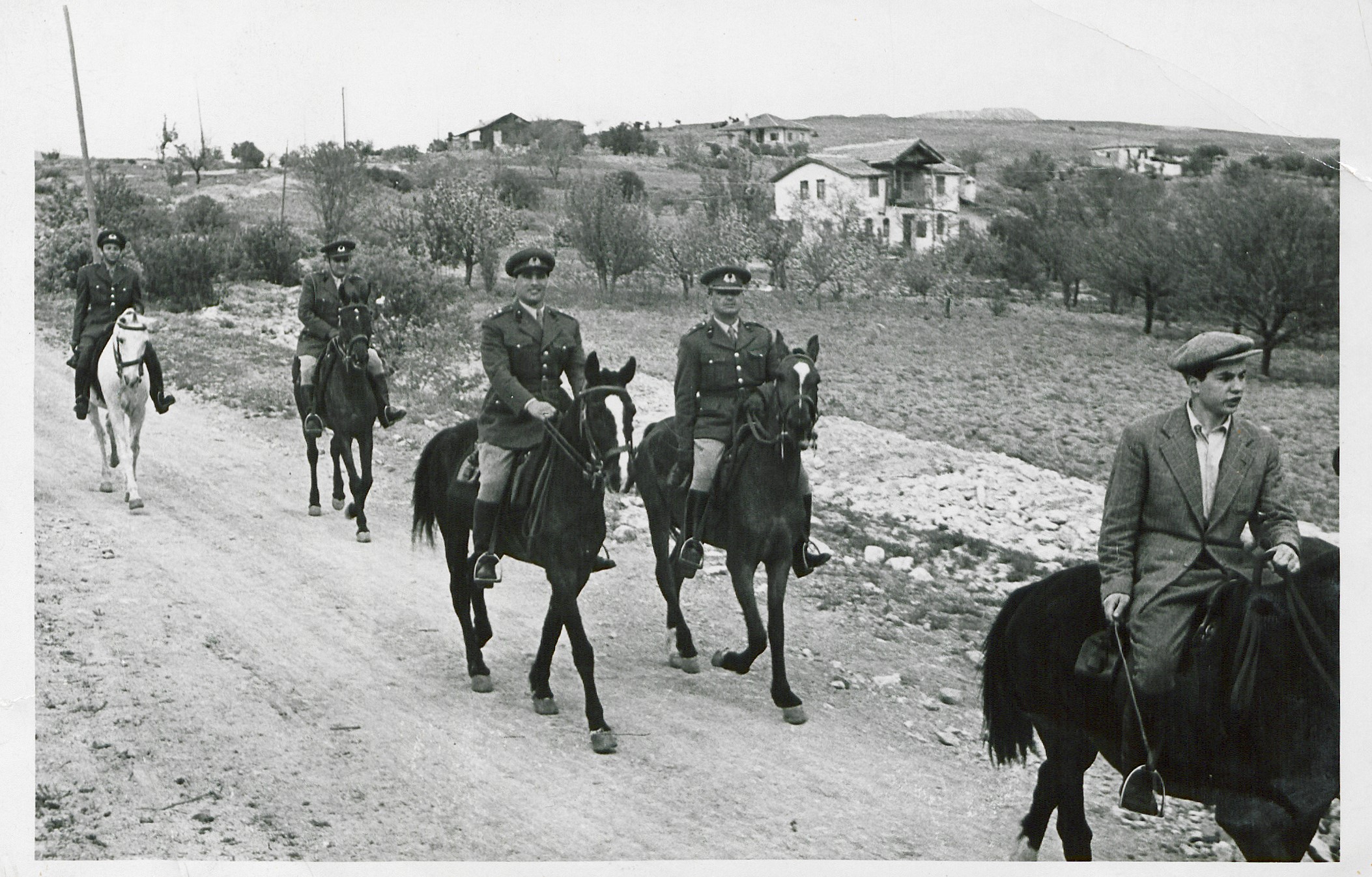
Guard Regiment in Keçiören (VEKAM Archives)
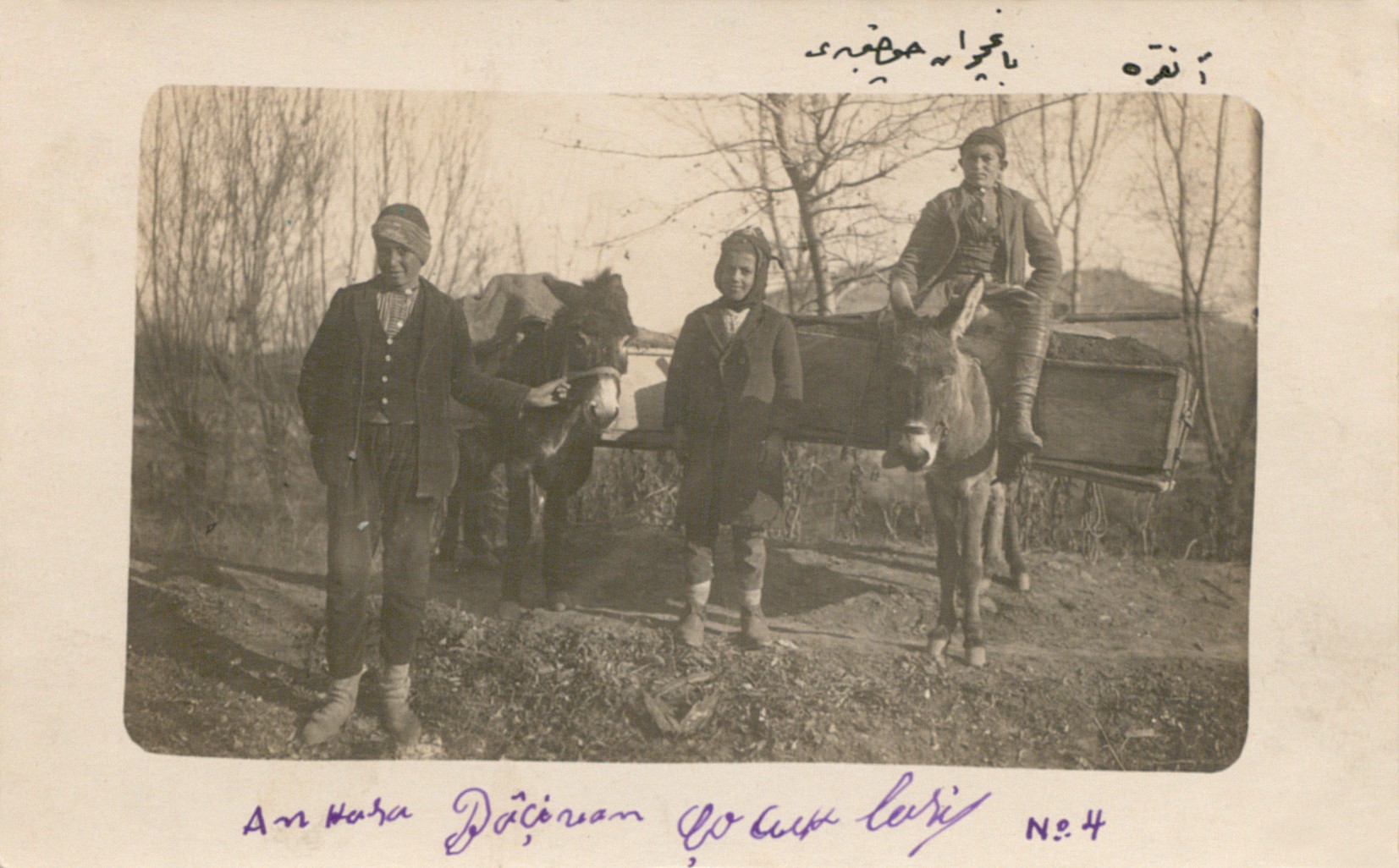
Spring and Children in Keçiören (VEKAM Archives)
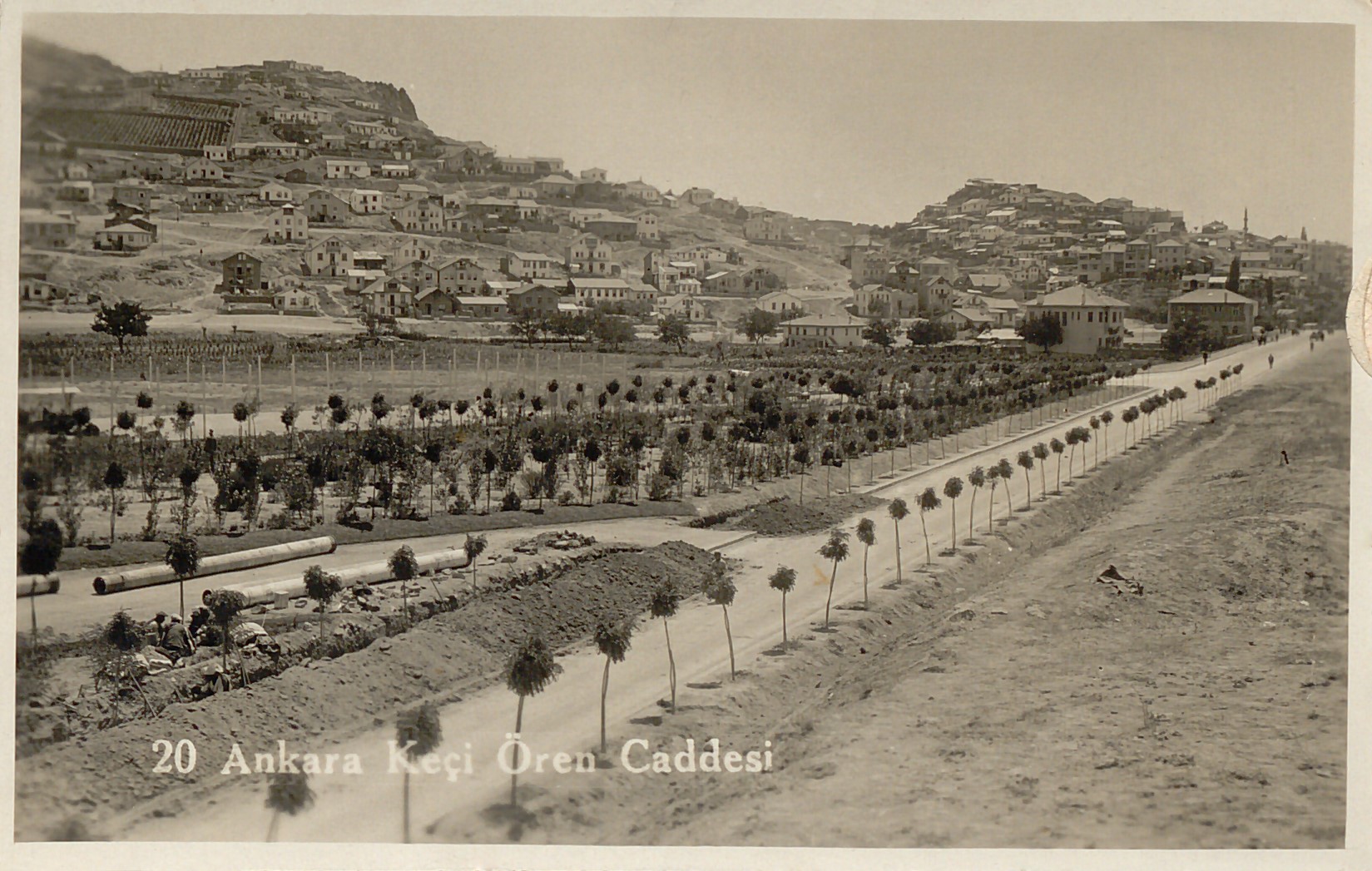
Keçiören Street (VEKAM Archives)
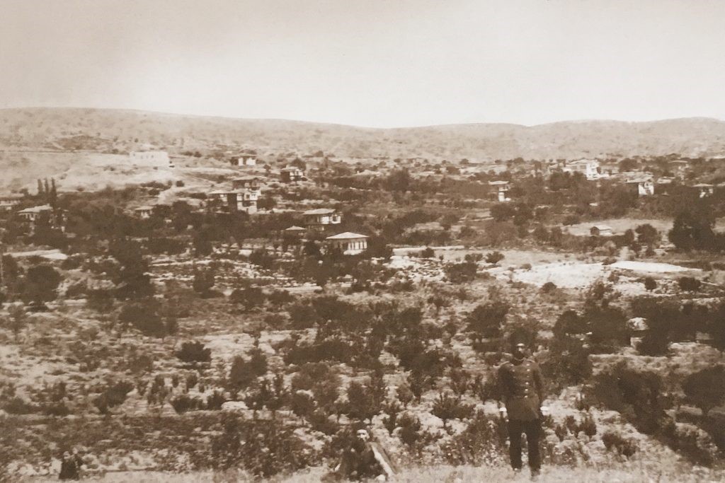
Keçiören Vineyards (VEKAM Archives)
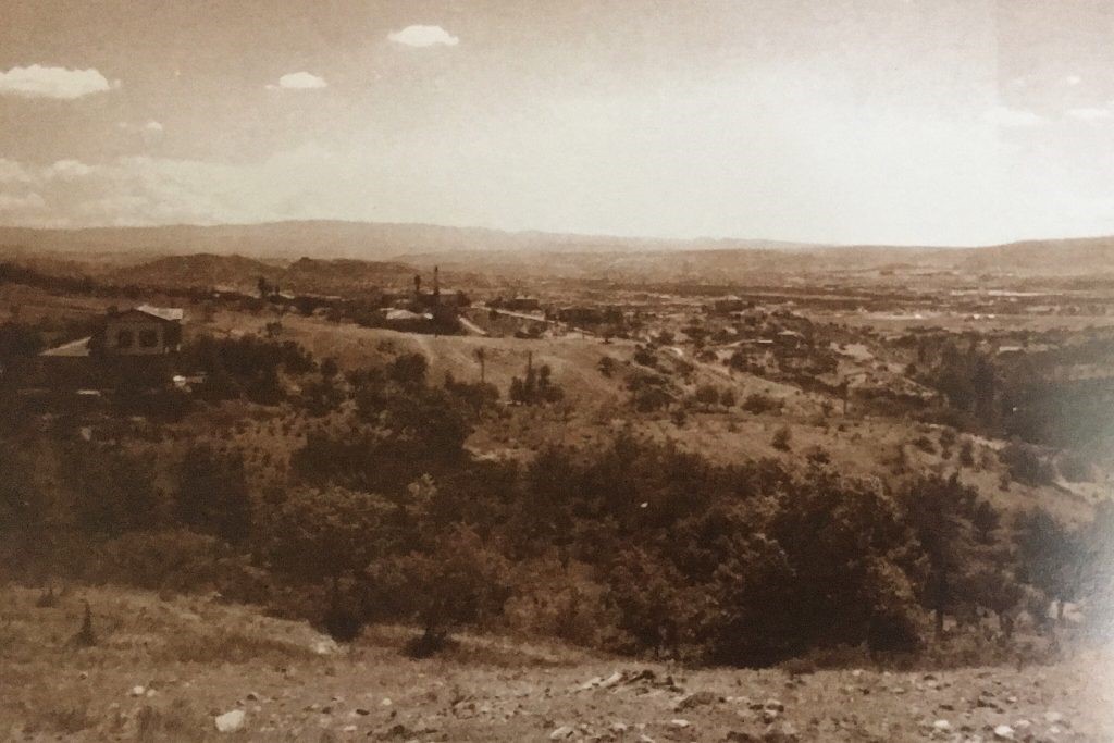
Keçiören Vineyards
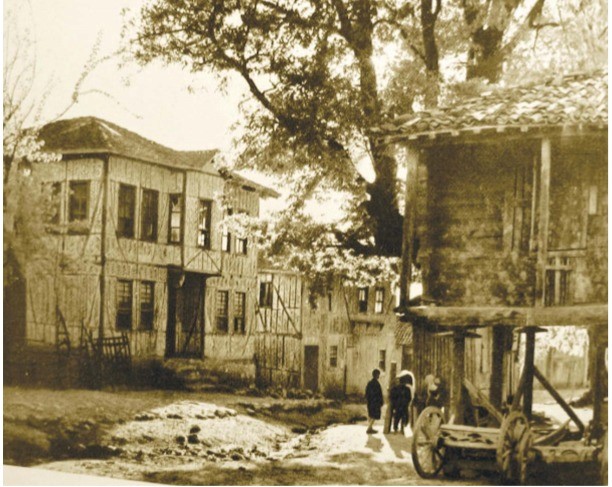
Keçiören Vineyard Houses
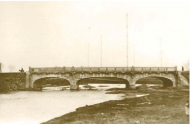
Built on the Çubuk Stream
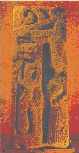
The Kybele Relief with Griffins Located in Etlik
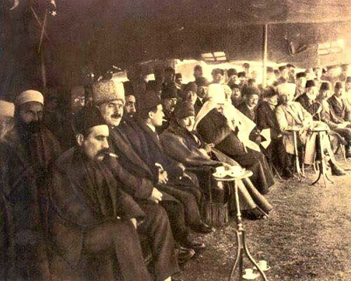
The First Nowruz Festival Held in Kalaba with the Participation of Gazi Mustafa Kemal Atatürk – March 1922
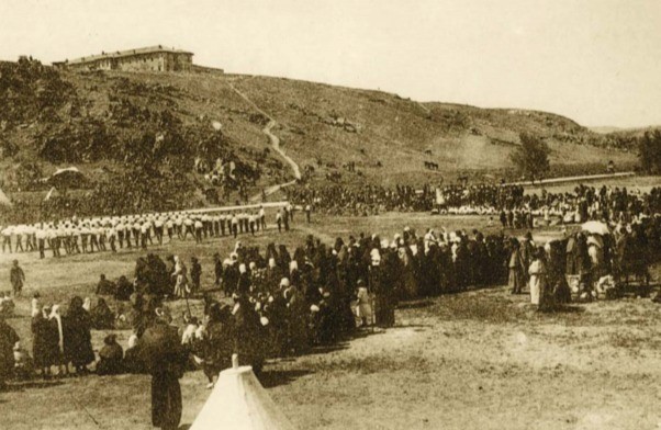
Nowruz Celebrations Held in the Kalaba Valley
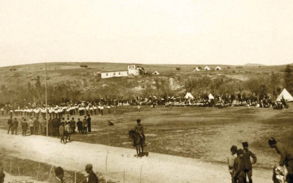
Nowruz Celebrations Held in the Kalaba Valley
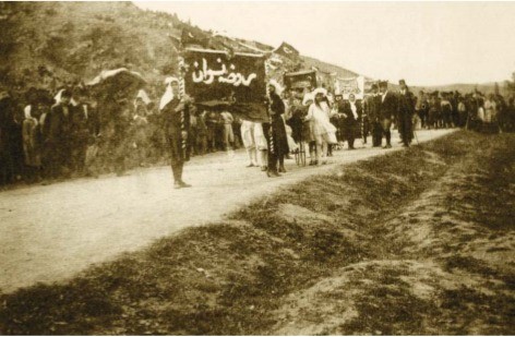
Nowruz Celebrations Held in the Kalaba Valley
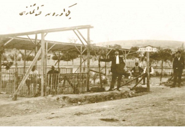
“Keçiören Coffeehouse”; the building visible in the background is Keçiören’s first school
References
Abdulkerim ERDOĞAN — Keçiören History and Culture Atlas
Timur Özkan — An Ankara Fragment from Keçiören to Etlik
VEKAM (Koç University Vehbi Koç Ankara Studies Research Center) — Photo Archives